
Following The Trail

On a recent family road trip across the U.S., roughly following the route of the historic trails of settlers headed west, I had the opportunity to try out Nissan’s version of their advanced driver assistance system (ADAS) in a recent model Nissan Rogue SL with all wheel drive. Branded as ProPilot Assist, Nissan’s ADAS combines radar-following cruise control with a forward-facing camera located behind the rearview mirror which detects the lane markers of the current driving lane and tries to maintain speed, distance to preceding vehicles, and centering in the current lane. It provides a much more limited version of automatic driving than in Tesla’s “full self driving” beta that I’ve reviewed previously.

When I picked up the Rogue at the Kansas City, MO airport, there was no owner’s manual in the glovebox, so at first I was reluctant to press the blue button on the steering wheel (see above), whose icon looked like it could be some sort of wireless service and end up making a call to a call center.1 I had to figure it out by researching online during one of our early hotel stops, before we headed out for days of highway driving.
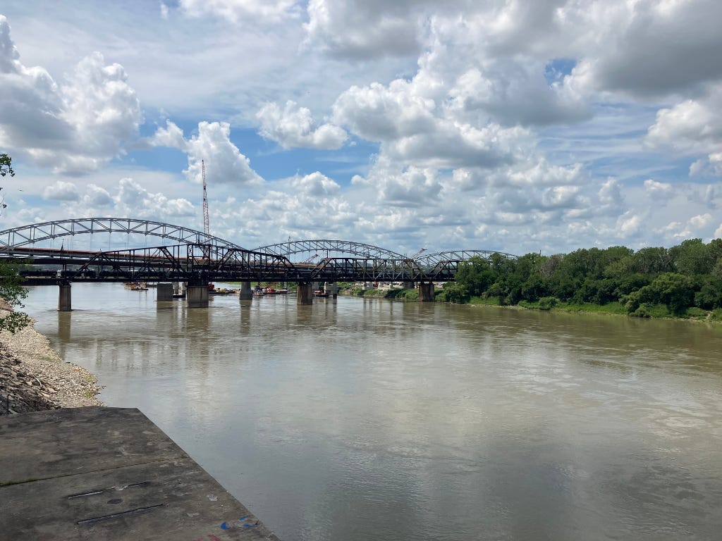
Starting our journey in President Harry Truman’s hometown of Independence, MO, which is where many travelers on the Oregon Trail began their journey at the steamboat landing north of the city2, we toured Truman’s home and the well-presented museum at Truman’s presidential library. Driving into Kansas City, we stopped at the Town Of Kansas Bridge, which marks another steamboat landing where settlers would disembark before gathering their supplies and equipping their wagons for the westward trail.
Town Of Kansas Bridge doesn’t actually cross the Missouri River, unlike the pedestrian bridge which now spans the Mississippi here in Memphis alongside the 1916 Harahan Bridge at the South Bluffs, but is a pedestrian overpass above the rail lines along the river bank and ends in an observation tower looking out over the waterfront of Kansas City’s side of the Missouri.
Unlike the 19th-Century settlers, who would take months to cross the Great Plains, we aimed to do it in a few days, ending our trip in Salt Lake City, before flying home. Instead of walking alongside and guiding the the ox team of our wagon, we had the advantages of air conditioning, smooth paved roads, and GPS, along with this “smart” driving technology (once I figured out how it worked).

Actually, it was surprisingly easy, and the blue ProPilot3 button’s position near the recognizable cruise control buttons on the steering wheel should have suggested its function. Nissan introduced ProPilot to the U.S. market back in 2018 on the Rogue, and at least while I had the vehicle, I used both its radar-based cruise control, and lane keeping features. There may be a way to turn the lane keeping portion of Propilot off, but it seems to have been on by default, and both features are activated when you’ve pressed the ProPilot button and set your speed in cruise control.
I’d had some familiarity with Toyota’s version of ADAS, called Safety Sense4, and both it and the Nissan ProPilot system use similar sensors, but Toyotas ADAS requires a separate button press to add lane keeping to the set cruise control, rather than unifying them into one button as Nissan does.
Crossing the Mississippi into Kansas, we soon left urban development behind, and headed southwest to get a look at what the Great Plains used to look like before agriculture took over. The Rogue’s ProPilot assist was excellent at following the straight or gently curving interstate, and maintaining set speed and distance. We only took a rest stop at Tallgrass Prairie National Preserve near Strong City, KS, opting instead to view the preserved prairie lands along the Flint Hills National Scenic Byway which runs north of the preserve along Kansas 177 towards Council Grove.5
Starting out the next day from our hotel in Junction City, KS we went to nearby Ft. Riley, now the home base of the U.S. Army’s 1st Infantry Division (“The Big Red One”) to visit the U.S. Cavalry Museum. Ft. Riley was originally one of numerous U.S. Army forts established in the West which provided security and way stations for settlers making their way across the wilderness as part of the U.S.’s policy to extend control and support homesteading across the continent. The horse soldiers of the U.S. Cavalry were based out of these forts, but mechanized infantry and helicopter-based “air cav” eventually supplanted the horse during the 20th Century. Ft. Riley honors that history with the gravesite of “Chief,” the last U.S. Army cavalry horse, who died in 1968, and is buried upright in front of the U.S. Cavalry Memorial.

Continuing the military history, down the road in Abilene, KS is the boyhood home and presidential library and museum of Gen. Dwight D. Eisenhower, former Supreme Allied Commander in Europe during WWII. Eisenhower’s participation in the First Transcontinental Military Convoy in 1919, which used the (at best) gravel road known as the Lincoln Highway, informed his decision later as President to embark on the creation of the Interstate Highway System. The Lincoln Highway later became parts of U.S. Route 30 and Interstate 80, the latter of which we used across much of Nebraska and southern Wyoming.
The plains across Kansas and Nebraska are now fruited with seemingly endless fields of corn and soybeans, but having a vehicle whose systems relieve the driver of much of the monotonous part of driving (maintaining speed and spacing, and staying in one’s lane) made it much easier to contemplate the distances and accomplishment of those who walked west alongside their wagons, or who, like many of the Mormon settlers, pulled their belongings in carts themselves.
Nissan says that its ProPilot system will provide “small steering inputs” to keep the car in its lane, and during our trip I did notice that some curves, particularly those involving noticeable lateral G forces, are too much for it to compensate for. Like Tesla’s “full self driving” beta, Nissan’s ProPilot expects you to keep your hands at least gently on the wheel, but seems to do much less nagging about it than the Tesla, presumably because it lacks fewer sensors (particularly an in-cabin camera) to monitor driver attention. The Nissan’s primary means is detecting the driver’s hands on the wheel with a torque sensor.
Automatic lane keeping evolved from lane departure alert systems, so if you fail to signal when changing lanes, the system will beep at you, because it has no other way of knowing that your lane departure was intentional. Unlike the Tesla, which can wait and change lanes automatically when it’s safe to do so after receiving an input via the turn signal stalk, Nissan ProPilot relies on manual lane changes, and when it has re-acquired the lane markings in the new lane, it beeps as the new lane markers are detected, and begins lane keeping again.6
Driving north into Nebraska, we visited the iconic Archway monument and museum in Kearney, NE7 which tells the story of the trails alongside the Platte River8 and their historical evolution through a series of walk-through interactive dioramas, accompanied by an audio guide narration. In covers not only the westward migration, but the coming of the Transcontinental Railroad, the Lincoln Highway, and the Interstate system. The Archway building itself straddles Interstate 80, so you can’t miss it. It’s an excellent and interesting museum, and as you walk through, you can use your audio guide to scan tags on parts of each scene to hear more about them. North of the Archway, a pedestrian bridge crosses the clear waters of a manmade lake beside the Platte River’s north channel, and a seven piece sculptural group titled “We Stayed” by David Biehl adorns the Archway’s entrance plaza.
(For those of you receiving this as an email newsletter, I’m nearing the length limit, but I’m going to keep this to one article, so if you want to hear about the remainder of the journey, you may need to read the rest on Substack.)
Before the coming of the telegraph put them out of business, the relay riders of the Pony Express briefly operated a pricy express mail service that used the overland trails from St. Joseph, MO to Sacramento, CA, and a few of their relay stations are preserved, including one we visited in a park in Gothenburg, NE.
A bit farther up the trail from there, just north of North Platte, NE, is the ranch of Western impresario William F. “Buffalo Bill” Cody, whose Wild West Show presented the myth of the West as entertainment to audiences in American cities and in Europe. East of the city, the waters of the North Platte and South Platte rivers converge, flowing towards the Missouri River, and eventually the Mississippi. West of the city, we entered into the Mountain Time Zone.
In western Nebraska, as cornfields give way to ranch land, you begin to see natural landmarks that the travelers on the Oregon and other westbound trails were grateful to at last reach. First the lone spire known as Chimney Rock, and then within sight of it, Scotts Bluff National Monument.

Our trip coincided with the last few days of the famous Sturgis motorcycle rally over 200 miles north in the Black Hills of South Dakota, but there were some bikers who were already headed home, so the parking lot of our hotel in Scottsbluff, NE had a small “Indian” encampment out front. We would see other riders from time to time crossing the Western landscape, enjoying the freedom of the open road.
Though we had visited Yellowstone National Park and the Grand Tetons in the northwest corner of the state several years ago, southern Wyoming was new to us, as we continued to follow the trail, and the North Platte River’s grand curve through Wyoming. Though mountains were visible in the distance, the westward trails understandably favored flatter lands near a water source.
Our next stop, the partially reconstructed remnants of historic Fort Laramie, showed something of life on a prairie outpost, where approaching visitors could be seen for miles.
Near Gurnsey, Wyoming, a light rain was falling as we reached the Oregon Trail Ruts National Historic Site, where the iron bands of countless wagon wheels cut deep into the soft rock atop a ridge, leaving ruts still visible today.
Further north, another landmark on the westward trails, Independence Rock, is notable for the many names that were carved into it by travelers. Most are illegible now due to erosion, and lichens covering them.

Past Independence Rock, we left the North Platte behind, and followed one of its tributaries, the Sweetwater River, entering the Great Divide Basin. We wanted to top off our gas at the junction called Three Forks, but the gas station there was out of fuel.9 Another modern problem was that this sparsely populated region of southern Wyoming has almost no cell service. With faith in the fuel efficiency of the Rogue, and lacking much of a choice, we pressed on westward towards South Gap, and a couple dozen miles later found a lone self-service pump at a tiny store which said it was available 24 hours a day, and took credit cards.
As with all lane keeping technologies which use camera detection of the lane boundaries, there are certain conditions which can cause the system to lose track of the lane markers. Towards the end of our trip, as we went down a desert road looking for where the Oregon Trail crossed the Continental Divide in southern Wyoming, the dust from the gravel road disabled the ProPilot system for the remainder of that day’s route.10
Similarly, in situations where the camera is obstructed by heavy rain, or the lane markings are worn down or absent, or in low contrast or high brightness situations (particularly when driving towards the sun), the system may not be able to function. Weather on our trip was fortunately very nice, and we only ran into a few light rain showers, which didn’t faze the lane keeping system at all.
When we made it to Salt Lake City the next morning, we spent unwanted hours in the airport due to a flight delay, finally making it home at 1:00 in the morning the following day. But these few problems at the end of our trail were nothing in comparison to the challenges faced by those who followed this route almost two centuries earlier.
—end—
I’d wondered whether that button would do something similar to GM’s OnStar service.
The steamboat landing is, of course, long gone, and the ownership of the area where it was makes the banks of the Missouri River less convenient to access here than in nearby Kansas City.
Nissan brands the feature as ProPilot Assist in the United States, apparently for legal reasons, but for the sake of readability, I’m going to abbreviate it as simply ProPilot.
In new Toyota vehicles, the lane keeping setting is turned off by default. When I took delivery of a new Toyota recently, I was a first wondering why the lane keeping system didn’t seem to work, and digging into the settings menus, I found that you needed to enable it in settings before the lane keeping button would work.
The preserve, which is owned by The Nature Conservancy and co-managed with the National Park Serive, features a herd of buffalo, but Memphis has its own buffalo herd at Shelby Farms, our large urban park, so this wasn’t our first opportunity to see the massive animals that were such an important part of the story of the American West, and the culture of the Plains Indians. With gently rolling hills stretching off to the horizon, but little available wood for cooking fuel, 19th Century travellers on the emigrant trails used dried buffalo dung for their campfires.
By contrast, Toyota’s Safety Sense’s lane keeping only beeps when it loses the lane markings, alerting the driver to resume control, rather than beeping each time it detects them. So in the Nissan, a successful lane change usually produces two beeps, one for the markings on each side of the lane as they are detected.
Kearney, NE is named for historic Ft. Kearney, which was dismantled in 1875.
The Platte River was an important water source for the settlers moving west, and the historic trails tended to follow it along. In our journey, we crossed the Platte River so many times, it became a bit funny.
Perhaps the “Indians” had got there first?
“How annoying,” I thought sarcastically. “I have to press the accelerator and steer now!” I remembered the scene from Star Trek IV (1986), where 23rd Century starship chief engineer Montgomery Scott is told he needs to use the mouse and keyboard to talk to the 20th Century computer after the USS Enterprise crew travels back in time. “How quaint!”

A bonus anecdote: When we were looking at the prairie schooner display near Scotts Bluff National Monument, a guy in another group of tourists who was walking back from there quipped: "We just came back from Oregon. Too many crazy people there."
I'm not sure whether he was joking. 😉
This good. I actually found myself paying more attention to the details of your trip rather than your review (no offense intended. It was interesting) I always wanted to do this trip. I’d like to take it all the way to Oregon City. Thank you!